pyroCB
This is the short form of pyrocumulonimbus. It is one of the many names given what we would commonly call a firestorm, that is, a weather event created by a huge and intense bushfire. The meteorologists would prefer to call it a cumulus flammagenitus, that is a type of cumulus cloud generated by thermal currents created by a fire. If we are learning this term now it is because in the last summer the frequency of pyroCBs has skyrocketed.
From 1998 (when they were first recorded) to 2018 there were 62 confirmed pyroCBs. In this bushfire season there were 30 confirmed pyroCBs with another 15 waiting confirmation.
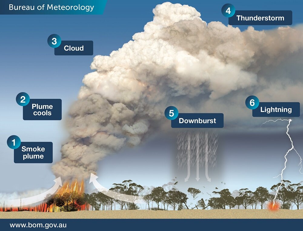
An intense fire with smoke and heat rising in a plume draws in cooler air. The movement of air upwards caused by the fire is called pyroconvection. If the system is strong enough, the cool air starts to condense the moisture in the plume, forming a cumulonimbus cloud. The cloud can produce a thunderstorm, a pyrocumulonimbus, which can throw spot fires up to thirty kilometres away. The lightning from the storm can start new fires. There is also the possibility of a fire tornado or firenado, that is, a revolving column of fire which can be a couple of hundred metres across and which can go more than ten thousand metres high. The mini versions of the firenado are called fire whirls. PyroCBs are dangerous to be around and they have devastating effects on the fireground.